 Southern Interior - Hwy 6
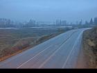
Lumby - W
Highway 6 at Mountain View Avenue, looking west.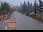
Lumby - E
Highway 6 at Mountain View Avenue, looking east.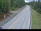
Shuswap Hill - W
Highway 6 at Shuswap Hill west of Cherryville, looking west.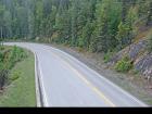
Shuswap Hill - E
Highway 6 at Shuswap Hill west of Cherryville, looking east.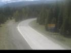
Monashee Pass
Highway 6 about 83 km east of Vernon, looking westbound.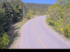
Needles Ferry Bend End
Highway 6 at Needles Ferry Landing, looking west away from ferry landing towards Needles Road N.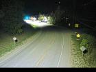
Needles Ferry Bend Middle
Highway 6 at Needles Ferry Landing, looking east to ferry landing.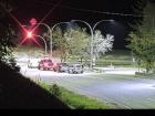
Needles Ferry Rest Area
Highway 6 at Needles Ferry Landing, looking east towards front of line up near the rest area.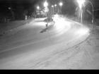
Needles Ferry Front - W
Highway 6 at front of Needles Ferry Landing line up, looking west.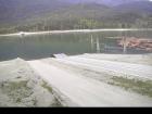
Needles Ferry Front - E
Highway 6 at front Needles Ferry Landing line up, looking east.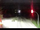
Fauquier Ferry - W
Highway 6 at Fauquier Ferry Landing, looking west.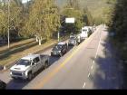
Fauquier Ferry - E
Highway 6 at Fauquier Ferry Landing, looking east.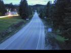
Fauquier at Starlite Road - W
Highway 6 at Starlite Road, looking west towards Fauquier.
Fauquier at Starlite Road - E
Highway 6 at Starlite Road, looking east towards Burton.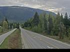
Burton Main Road
Highway 6 in Burton at Burton Main Road, about 22 km north of Fauquier, looking south.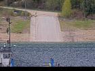
Arrow Park Ferry North Terminal
Highway 6 at South Arrow Park Ferry Terminal, 22 km south of Nakusp at junction of Upper and Lower Arrow Lakes, looking at north landing.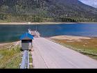
Arrow Park Ferry South Terminal - N
Highway 6 at South Arrow Park Ferry Terminal, 22 km south of Nakusp at junction of Upper and Lower Arrow Lakes, looking north.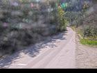
Arrow Park Ferry South Terminal - S
Highway 6 at South Arrow Park Ferry Terminal, 22 km south of Nakusp at junction of Upper and Lower Arrow Lakes, looking south on Arrow Park Road.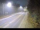
Nakusp - N
Highway 6 and Highway 23 Junction in Nakusp, looking north on Highway 6.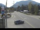
Nakusp - S
Highway 6 and Highway 23 Junction in Nakusp, looking south on Highway 6.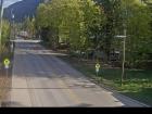
New Denver
Highway 6 at Highway 31A in New Denver, looking north.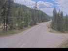
Lemon Creek
Highway 6 at Kennedy Road/Lemon Creek Road about 8 km south of Slocan, looking south.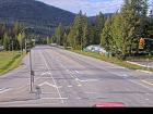
Playmor Junction - N
Highway 6 and Highway 3A at Playmor Junction, looking north.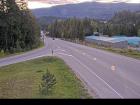
Playmor Junction - W
Highway 6 and Highway 3A at Playmor Junction, looking west.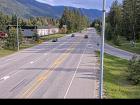
Playmor Junction - S
Highway 6 and Highway 3A at Playmor Junction, looking south.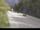
Nelson - N
Highway 6 near Highway 3A and Rosemont/Uphill interchange, looking north.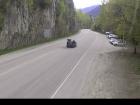
Nelson - S
Highway 6 near Highway 3A and Rosemont/Uphill interchange, looking south.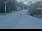
Whitewater
Highway 6 at Whitewater Ski Hill Road about 12.5 km south of Nelson, looking north.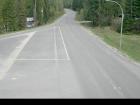
Ymir
Highway 6 in Ymir at First Avenue, looking south.


