 Southern Interior - Hwy 3
Hwy 3 at Highway 3/5 Junction
Highway 3 at Highway 3/5 junction, looking east.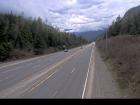
Hope Slide
Highway 3 at the Hope Slide pullout, looking east.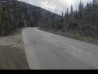
Allison Pass - W
Highway 3 about 10 km west of Manning Park resort area at Allison Pass, looking west.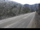
Allison Pass - E
Hwy 3 at Allison Pass, 10 km west of Manning Park resort area, looking east.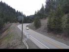
Similkameen Falls - W
Highway 3 about 6 kms east of Eastgate near Similkameen Falls, looking west.
Similkameen Falls - E
Highway 3 about 6 kms east of Eastgate near Similkameen Falls, looking east.
Sunday Summit - N
Highway 3 about 32 km south of Princeton, looking north.
Sunday Summit - S
Highway 3 about 32 km south of Princeton, looking south.
Princeton
Highway 3 at Frontage Road on the west side of Princeton, looking south.
Bromley Rock - W
Highway 3 about 1.4 km east of Bromley Rock Provincial Park, looking west.
Bromley Rock - E
Highway 3 about 1.4 km east of Bromley Rock Provincial Park, looking east.
Keremeos - W
Highway 3 at Keremeos Bypass Road, looking west.
Keremeos - E
Highway 3 at Keremeos Bypass Road, looking east.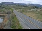
Mount Kobau - W
Highway 3 next to Conifryd Lake, looking west.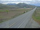
Mount Kobau - E
Highway 3 next to Conifryd Lake, looking east.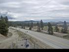
Anarchist
Highway 3 about 9 km west of the Anarchist Summit, looking east.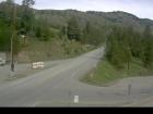
Rock Creek
Highway 3 at Highway 33 junction in Rock Creek, looking northwest.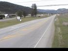
Midway - W
Highway 3 at Florence Street in Midway, looking west.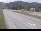
Midway - E
Highway 3 at Florence Street in Midway, looking east.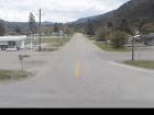
Midway - S
Highway 3 at Florence Street in Midway, looking south.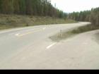
Eholt Summit
Highway 3 about 16 km northeast of Greenwood at Wilgress Rest Area near Eholt Summit, looking westbound.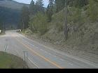
Christina Lake - NW
Highway 3 at East Lake Drive on east side of Christina Lake, looking northwest.
Christina Lake - SE
Highway 3 at East Lake Drive on east side of Christina Lake, looking southeast.
Paulson Summit
Highway 3 near the Paulson Summit, looking west.
Castlegar - W
Highway 3 at 14 Avenue in Castlegar, looking west.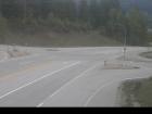
Castlegar - E
Highway 3 at 14 Avenue in Castlegar, looking east.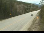
Bombi Pass
Highway 3 about 22 km south-east of Castlegar at the Bombi Summit, looking west.
Meadows Junction
Highway 3 at Highway 3B junction looking westbound.
Salmo
Highway 3 at Highway 6 junction, looking west on Highway 3.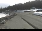
Kootenay Pass
Highway 3 at Salmo Creston Highway Summit, looking east.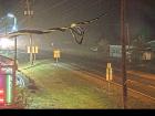
Creston - N
Highway 3 and Highway 3A junction in Creston, looking north.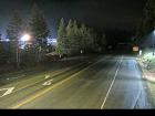
Creston - W
Highway 3 and Highway 3A junction in Creston, looking west.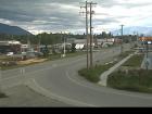
Creston - S
Highway 3 and Highway 3A junction in Creston, looking south.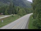
Leadville Road
Highway 3 about 18 km east of Creston in Kitchener, looking east.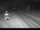
Goatfell - W
Highway 3 about 9 km northwest of Yahk near Goatfell, looking west.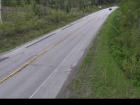
Goatfell - E
Highway 3 about 9 km northwest of Yahk near Goatfell, looking east.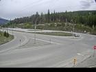
Yahk
Highway 3 at Highway 95 junction by the Yahk Weigh Scale, looking northeast.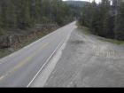
Irishman - N
Highway 3 about 21 km southwest of Moyie, looking north.
Irishman - S
Highway 3 about 21 km southwest of Moyie, looking south.
Moyie Lake
Highway 3 near the south end of Moyie Lake, looking north.
Cranbrook
Highway 3/95 at 9 Avenue in Cranbrook, looking northeast.
Steamboat- NW
Highway 3/93 near Ha Ha Creek Road, looking northwest.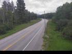
Steamboat - SE
Highway 3/93 near Ha Ha Creek Road, looking southeast.
Elko - W
Highway 3 about 1 km west of Elko at Highway 93 junction, looking west.
Elko - E
Highway 3 about 1 km west of Elko at Highway 93 junction, looking east.
Elko - S
Highway 3 about 1 km west of Elko at Highway 93 junction, looking south.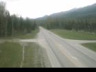
Morrissey
Highway 3 about 10 km south of Fernie at Morrissey Junction, looking north.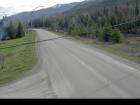
Hosmer
Highway 3 about 12 km north of Fernie in Hosmer, looking north.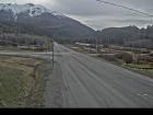
Sparwood
Highway 3 about 2 km west of the Alberta border at Sparwood Weigh Scale, looking southeast.


